This is a trip I’ve wanted to do for a long time. I’ve paddled from Skamokawa to Astoria several times in the last couple of years, and the last time I went down there, I felt like I had energy to spare and joked with my clients that we should paddle back with the flood tide. They looked at me like I was crazy…

It is about 19 miles or so to paddle from Skamoakwa to Astoria, and so doubling that would come in at just under 40 miles, the longest paddling day I’ve ever done. When Ginni and I were building the schedule a few weeks ago, we were looking for a compatible tide series for this trip, and the only one that was available to us demanded a 4 AM departure from Skamokawa. We looked at each other and said, “Why not?”

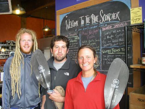
The plan was to paddle to Astoria on the ebb tide, arrive around 8:30 or so, and eat breakfast at the Blue Scorcher bakery, just a couple of blocks up the hill from the Maritime Museum. Then when the tide turned, we would head back upstream to Skamokawa.


What 4:30 in the morning looks like

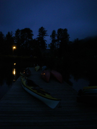
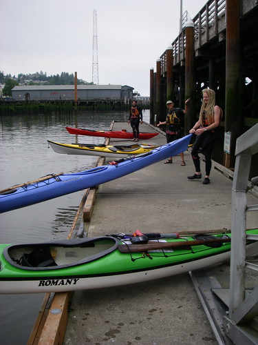
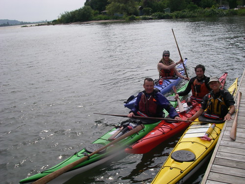
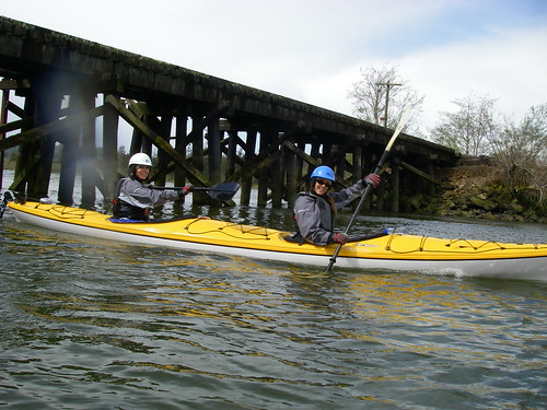
So we dragged our butts out of bed at an unnatural hour, made our way down to the dock, and set out downstream, leaving Skamokawa at 5 AM. There was a strong current flowing out and my new GPS showed us zipping along at 7 mph. Ginni borrowed the GPS and got her kayak up to 8.5 mph for a moment.

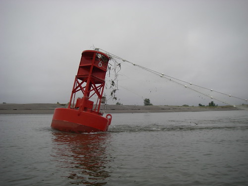
Down below Miller Sands, where the shipping channel turns towards Astoria, the dredge equipment was working, and we also saw this buoy, tangled in several hundred feet of gillnet. I’ll digress here for a minute. First of all, these nets are not cheap! Why anybody would lay out thousands of dollars worth of net in a place where they would risk tangling it this severely is beyond me. And it wasn’t just snagged on the end, either; whoever did this evidently drifted down on this buoy with the net strung out for hundreds of feet on both sides of it. But what really gets me is that after it tangled on the buoy, they just cut it loose and abandoned it, as a hazard to fish and to navigation. The bright side of this story is by the time we passed this buoy again on the way home, the guys running the dredge equipment had removed the net and piled it on one of their barges.


number 6, festooned with gillnet

That last leg of the paddle from Rice Island to Astoria is a long one, since the destination is in plain sight for so long, without seeming to get much closer. Finally we starting pulling up on Tongue Point, just east of town.


approaching Tongue Point

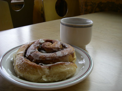
By this time, we were starting to smell the cinnamon rolls and coffee!


Ginni

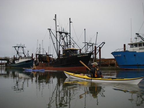
Not long after, we were pulling into the East Mooring Basin to see if there were any lingering sea lions hanging around. We only saw one, apparently not with the program as most of the rest of the gang is off to California to the breeding grounds.


entrance to the East Mooring Basin

Here’s a great name for a fishing boat, huh? And a bottom dragger to boot! Last year, the trawling industry here was hit with scandal when they were caught dumping and grinding up protected rockfish bycatch to prevent their whiting season from being shut down. Nice, huh? Little was done about it and they continued to fish for whiting even after being caught cheating the system. And this year, when salmon fishing is sharply curtailed all up and down the coast, the trawl industry gets to kill 11,000 Chinook salmon as bycatch. Can you tell I’m not a fan of the trawl boats?


God's Will?

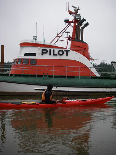
I don’t know much about this boat, except that it is an old, out of service pilot boat. It is a beauty though, with such a great color scheme. Here’s what I found when I googled it.


kayak and pilot boat

We paddled under the old red cannery building that was so damaged in last winter’s windstorm and then up to the dock at the Columbia River Maritime Museum. The mileage to this point, measured by GPS, was 19.4 statute miles and we did it in 3 hours and 15 minutes. Not too bad! But we knew the return trip wouldn’t be so quick…


under the cannery


Astoria


the dock at the Maritime Museum

After changing into “cilvilian” clothes and stowing the kayaks, we headed up to the bakery, where we spent an hour or so hanging out drinking coffee and eating breakfast. Josh looks like he’s still asleep though!


at the Blue Scorcher


at the Blue Scorcher

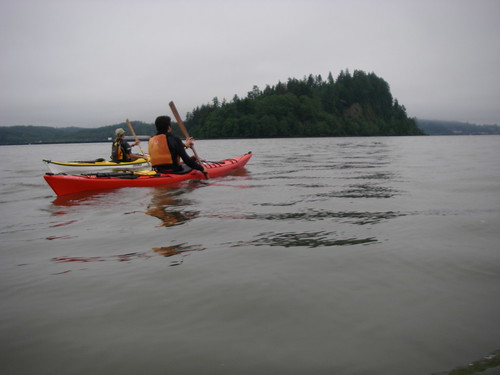
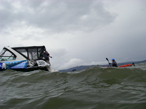
We got back on the water about 10:30, when we saw the ships at anchor starting to swing around with the change of the tide, and headed back past Tongue Point, where we saw four or five sturgeon jumping and rolling in just a few hundred yards. What makes them do that?

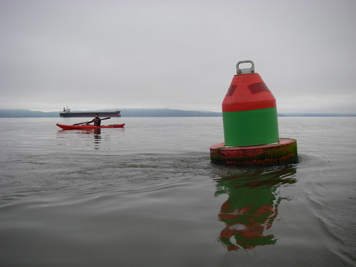
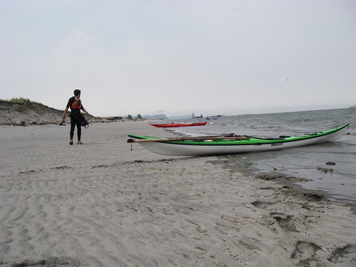
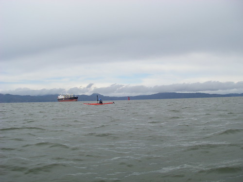
While our average speed on the downriver leg was 6.4 mph, now we were only averaging 4.3, and as we pulled alongside Rice Island and the dredge equipment again, the wind was starting to blow. We stopped on Miller Sands for a quick break and then continued on.


taking a break

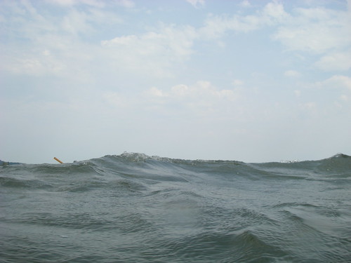
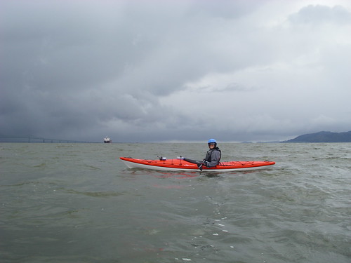
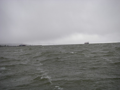
This part of the trip was much less smooth than the first part, and we were soon surfing wind waves, and, around 30 miles or so, were starting to feel a bit tired! We took another break below Jim Crow Point and then got back to work for the last 5 miles or so. This part of the trip had only taken 50 minutes earlier in the day, now it took almost twice that! As we were pulling up next to Skamokwa, we were actually starting to notice an ebb current again.


where's the kayaker?

We finished the trip back at our home dock at 4 PM, eleven hours after we had begun. We covered 39.2 miles in eight hours and five minutes of paddling time, according to the GPS. We were tired, my drysuit was leaking and our boats seemed heavier than ever before as we carried them up the ramp to the paddle center. I joked that next time we should do the same trip in whitewater boats, just to keep things interesting. Oddly, there wasn’t a lot of enthusiasm for that idea….


Finished!


finished and tired!

What a day!

Some months back, Columbia River Kayaking was contacted by one of the organizers of Eco-Challenge 2008 and asked to participate in this event. Eight lovely sports models were going to bicycle down to the river from Mt. Hood and then kayak to Astoria, ending the trip on Earth Day weekend, supposedly raising awareness about environmental issues along the way. And of course, looking really cool in their kayaking and biking gear.

Anyway, this was supposed to be an event that would be handled by one of the female members of the company, but in the end, she wasn’t able to get away from her other job in time, so I took it on instead. Last Saturday, Katie and I drove to Troutdale to give the girls a quick kayak safety lesson before their journey started the following Tuesday. Unfortunately, I wasn’t able to get them in the gear and in the water for a real kayak safety lesson and we had to settle for a lecture on dry land. We agreed to paddle with them on the last day of their journey, which was to be from Svenson Island, around Tongue Point and ending at the Maritime Museum on the Astoria waterfront.

There were a few critical things wrong with the plan, though. They were set to start out paddling downstream at 10 AM, against the incoming tide. Ideally, if one has to round Tongue Point at all, one would want to do that at a slack tide, when there is little water movement to kick up waves and clapotis. And of course, it would be better still to paddle with some help from the current rather than against it the whole way. At the last minute, the weather report – snow, hail and wind – forced a change in plans and I was told we would be starting out from the John Day boat ramp, much closer to town, and at 9:30 or so, which would have lined up with more favorable tides.

Alas, that was not to be. Katie and Josh and I arrived at the boat ramp at 9:15, after a harrowing morning which involved my new Subaru blowing a head gasket while crossing the Astoria bridge and a made-for-the-movies zip through town trailing steam all the way. We left my car at the Maritime Museum, and moved the kayaks onto Josh’s roof rack-less Geo and decided, incorrectly, that we were running too late now to stop for coffee and carbohydrates.

We got to the boat ramp and found no Eco-Gals had arrived yet, so we geared up and set to waiting. In the hail and snow.


hail!

The Eco-Chicks and their entourage finally showed up around 10:30 and spent close to an hour getting ready to get on the water. Check out the Ugg boots on one of them. When I took this picture, I didn’t even notice that. I had assumed and been assured that the girls were getting good gear to paddle in and I just left it at that. That was a mistake, but there was probably nothing I could have done anything about it anyway.


getting ready

It was close to 11:30 before they were all in their kayaks and we moved out of the boat ramp into the John Day River, accompanied by a giant powerboat provided by FMC Watersports in Portland, loaded with organizers and photographers. The girls’ boats all had little waterproof video cameras mounted on them as well. I sure would like to see some of that footage!

Here’s Megan and Aly in their double, just as we are entering the Columbia River. Look at those smiles! They don’t know yet what things will be like an hour from now. If only they all could have been in doubles…


Aly and Megan

We paddled out of the John Day and into the Columbia and turned left towards Tongue Point. There was a bit of a breeze coming through the gap behind the point and some of the paddlers were having a hard time tracking straight in the wind. I realized that several rudder pedals were not adjusted properly and when I went to fix one of them, I realized that the mechanism was totally broken.

So as soon as I was able to find a good beach, I pulled the whole crew up on dry land and ended up removing the broken rudder and stowing it inside and adjusting some more footpegs. At this point, we realized that the girls were already getting tired and hungry and had almost nothing in the way of snacks. “Oh, they gave us some Redline energy drinks,” one of them said. So we gave them all of our granola bars and a banana and got everyone back onto the river just behind Tongue Point. Note to interested parties: Energy drinks are not adequate fuel for intense exercise!

Tongue Point is a large basalt ridge, poking out into the Columbia River just upstream of Astoria. When the river hits this obstruction, flooding or ebbing, it creates standing waves, claoptis and generally turbulent water, even on a calm day. When wind is added to the mix, it gets even more exciting. Lewis and Clark were pinned down here for days by the wind and waves. It is not a place for beginners to paddle kayaks. Which is exactly what was going to happen next.


rounding tongue point

There was probably about a 15 knot breeze blowing and whitecaps all around the point. We gathered everyone together, gave some last minute tips and around we went. I think it probably took over 45 minutes to come around and get clear of the tidal turbulence. All along the way, the boat was right in front of us, with cameras clicking away. I’m sure some excellent photos were taken, but none by me. The lens on the little Pentax was continually wet and it was totally impossible to get a shot that included a horizon that didn’t slope to one side or the other. You get the idea, though, looking at the picture above. It was pretty lumpy water.

But we got around the point without incident; everyone was still upright and some were even smiling and talking about how beautiful it was. Good attitude! But some of the girls were starting to get truly exhausted. All the training and gym workouts in the world had not prepared them for this kind of work. And of course, a granola bar and an energy drink was not anywhere near enough real fuel to keep up this pace for as long as we needed to. We were still almost three miles from the end point, having traveled less than half of the distance so far.

We were starting to get spread out as a group and there was a pretty serious looking front approaching. The current was nearly one knot against us, so every time anyone had to stop for any reason, we lost ground quickly.


Krystal and the storm

As the rain was just starting to hit, I took these two pictures in quick succession. The first one is looking back towards the point and the trailing end of our little parade. The next one is about a minute later, looking ahead.


looking behind


looking ahead

Then the wind hit, and things really fell apart. I guessed the windspeed at about 25 knots or so, and it was filled with stinging rain. I was pushing on ahead with one of the girls nearby when I looked back and saw a kayak upside down. I turned around and went back and made the paddler with me come back too, just so she wouldn’t be alone. When I got there, there was gear all over the river, the paddler had let go of her boat and was hanging onto someone else’s boat and one of the other girls had the empty boat with her and was getting blown upstream towards some pilings. What a train wreck!

I sorted that out while Katie gathered up the gear; Josh was already towing someone so he was kind of pinned down. I got the empty boat back to the girl in the water, but it wasn’t quick or pretty. She had been in the water for at least a minute by this time. Brr! When I heaved her up on her boat, I realized that she had on only a thin pair of nylon pants, no neoprene and no polypro of any kind! Yikes! She was totally freaked out, did not (!) want to get back in the kayak and she was quickly picked up by the support boat. I didn’t realize until the end of the trip that she was the one wearing the Ugg boots. Note number two to interested parties: Ugg boots are NOT paddling gear!

Katie and Josh regrouped most of the rest of the gang and kept going so we wouldn’t end up going back around the point again, backwards. And in quick succession, as I checked up on two stragglers, they both opted out and were picked up by the boat. I think I paddled the stretch of water in front of Alderbrook five times by the time I caught up with the group. We pulled into the east mooring basin behind the seawall with the survivors and took a well earned rest. We shared the last granola bar amongst the seven of us that remained and finished the rest of my tea ( I am going to buy an extra thermos for days like this!) and then headed on towards the museum. When we popped out into the river again at the west end of the seawall, it was starting to get sunny and the river was calm enough that what we had just been through seemed almost unreal.


kayaker and ship

This was the last picture I took that day. Shortly after, we pulled up to the museum’s dock to the applause of the few folks who were waiting there. We each got filmed briefly for our comments, then we got the heck out of there, and headed up to the Fort George Brewpub to decompress and relax. And I had the first food of the day that wasn’t a granola bar. At four o’clock!

In a few minutes, I am going to get up and go over to Astoria with the car hauler trailer and pick up the Subaru. I’ve already been shopping for an engine. I guess my bad car luck wasn’t over yet after all..

What a long post! I hope that some of you get a chuckle or two out of it. I know a few people have been waiting for this entry.